A major winter storm roared into Duluth and northeastern Minnesota on Wednesday, with the Twin Cities metro area expected to feel some of its fury.
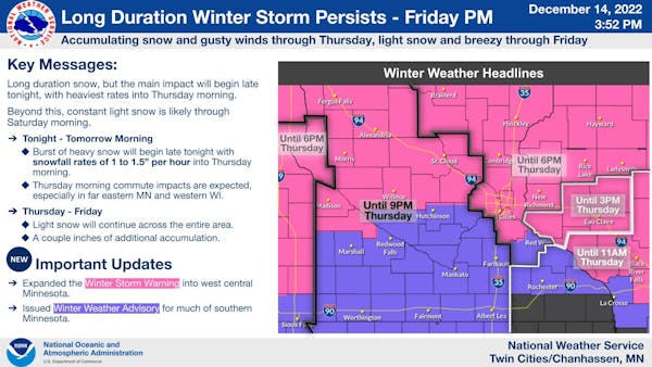
Some places along the North Shore were expecting nearly 2 feet of snow. A blizzard warning was in effect until 6 p.m. Thursday for the Duluth-Superior area and along the North Shore of Lake Superior, with multiple hazards expected including heavy snow, mixed precipitation and gusty easterly winds, the National Weather Service said.
By noon Wednesday, roads were covered and snow continued to fall. Snow totals by by late afternoon ranged from 10.5 inches in the Lester Park area of Duluth to 11.8 at the Weather Service office near the Duluth airport. The town of Finland had registered 15.5 inches by dinnertime.
But that was just the start, the Weather Service said. By the time the storm wraps up Saturday morning, more than 30 inches could pile up in parts of Duluth and the North Shore, said meteorologist Jonathan Wolfe. Duluth is forecast to come close to breaking the 1991 Halloween blizzard record for snowfall in a 48-hour period, with 31.8 inches outside the city center between Tuesday and Thursday. The record is 32.6.
"We are used to big storms — this is nothing exceptional," said Mike Giuliano, property manager at the AmericInn in Silver Bay, where some of the heftiest totals were expected.
The heavy dumping could bring a jump in business, Giuliano said, noting that big snowfalls often bring snowmobilers to the city north of Duluth.
"We pray for it," he said. "We are not crying."
A few guests extended their stay as road conditions deteriorated Wednesday, Giuliano said. The Weather Service warned that travel along the North Shore could become impossible throughout Wednesday and into Thursday.
No roads had been closed and the Minnesota Department of Transportation had not issued any travel advisories as of noon Wednesday. But "we encourage people not to be on the roads," said Margie Nelson, a MnDOT spokesperson. All 84 of MnDOT's plows in northeast Minnesota were deployed, she said.
The heavy, wet snow caused trees to sag and brought down some power lines. Minnesota Power reported several outages affecting a high of about 5,500 customers.
"This isn't our average snowstorm for the North Shore," Duluth National Weather Service Warning Coordinator Joe Moore said in a Facebook Live event. "This is a high-impact winter storm that will probably be one of the most powerful storms of the winter for the North Shore."
The storm prompted the Duluth Public Library and area schools to close, with Duluth schools closed again Thursday. The Spirit Mountain ski area also closed, and Bentleyville, the holiday lights festival in Bayfront Park, said it would shut down due to the blizzard.
"We will continue to monitor the weather and announce by tomorrow afternoon if we will be able to open or if we will be closed for Thursday," Bentleyville said in a Facebook post.
As the snow fell, the city reminded property owners to pace themselves while shoveling show: "Use your legs to lift, rather than your back. Take breaks when needed."
Only a light blanket of snow fell in the Twin Cities area by Wednesday morning, but it was enough to turn roads slippery, which made for a challenging morning commute.
MnDOT reported scores of spinouts and crashes on Twin Cities highways and freeways during the morning drive. By mid-morning, roads were mostly wet as temperatures climbed into the 30s.
With highs Wednesday reaching the mid-30s, most of the 1 to 3 inches of snow that fell overnight was expected to melt. But Thursday promised to be another rough drive to work or school, said Brent Hewett, a meteorologist at the Weather Service's Chanhassen office.
Two to 6 inches of snow could fall as the backside of the slow-moving system moves across the metro and central and southern Minnesota. By the time things wrap up Saturday morning, the Twin Cities is in line for 5 to 7 inches, Hewett said.
The St. Cloud area woke up to 5 inches of heavy, wet snow coating tree limbs, fences and streetlights Wednesday. The snowfall and an extended winter weather advisory for the area prompted the St. Cloud school district to transition to remote learning for the day, with all afternoon and evening programming canceled.
Metro snow totals ranged generally from 1 to 2 inches, but Buffalo in Wright County picked up 4 inches, according to the National Weather Service.
Ahead of the snow, nearly 0.3 inches of rain fell at the Weather Service's office in Chanhassen and 0.25 inches in Minneapolis. "That is a decent amount for December," Hewett said.
Behind the storm, temperatures will tumble to some of the coldest readings of the season. Highs in the Twin Cities by Monday will be in the single digits to the low teens, while lows could sink below zero for the first time this winter, the Weather Service said.
Staff writer Jenny Berg contributed to this report.