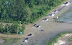
Tropical low pressure set to become a named tropical cyclone will continued tounload torrential rain across Australia's Top End for another few days.As of Tuesday morning, EST, meteorological data show that rainfall in and nearDarwin, capital of Northern Territory, has been 8 to 16 inches within 24 to 48hours.
High winds swept the area on Tuesday causing minor damage, as gusts reaching 50to 60 mph.
Two tropical lows off northern andnorthwestern Australia on Feb. 15, 2011 (Australia Bureau ofMeteorology).Weather radar at the time showed the center of low pressure spinning nearlyover Darwin with very heavy rain.
The storm disrupted local ferry services and led authorities to shut areaschools and public services for Wednesday, it was reported.
The center of low pressure is forecast to drift to the north and west, or awayfrom the Australian mainland, for at least another two days. This shift willallow for intensification and an upgrade from depression to named tropicalcyclone.
The Top End of Northern Territory, including Darwin, will remain prone todamaging winds and flooding rain through at least Thursday.
Meanwhile, a second tropical low, this one off the far north west of Australia,will also bear watching for the next day or two. The depression was centeredless than 250 miles northwest of Exmouth, Western Australia, with movementtowards the west.
This low has the potential to quickly become a strong tropical cyclone withinthe next one to two days.
Story by Jim Andrews, AccuWeather.com Senior Meteorologist.
Southern Brazil has been hit by the worst floods in 80 years. At least 37 people have died