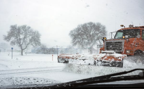
A winter storm shouldered its way into the record books Tuesday while dumping 6 to 8 inches of heavy snow across the Twin Cities, burying curbs, garden hoses and whatever was left of fall.
The precipitation tapered off Tuesday night after 7.9 inches of snow at Minneapolis-St. Paul International Airport, shattering the previous record for Oct. 20 of 3 inches, set in 1916, and nearly besting the all-time snowiest October day in the Twin Cities.
As flurries turned to a full-on storm, National Weather Service meteorologist Brent Hewett had simple advice: "Have a shovel" at the ready.
Accumulations were deepest in the southern metro with heavy wet snow falling up to an inch an hour: Edina reported 6.6 inches; Burnsville, 6.8; Savage, 8.8; and Apple Valley, 8.5. The widespread storm swept across much of the state from Interstate 90 in southern Minnesota to Alexandria, Brainerd and Duluth in the north.
The suddenly slick roads caused hundreds of crashes and spinouts, with the State Patrol reporting some 48 injuries, 493 crashes, 614 vehicles off the road, and 22 jackknifed semitrailer trucks between 11 a.m. and 8:30 p.m. In one case, a truck was blocking both westbound lanes of Interstate 94 near Alexandria. Heavy slush was reported on many highways early Tuesday evening.
In a brief Twitter video, Gov. Tim Walz urged people to be cautious but, like many, he didn't seem overly concerned about the record-busting snow: "Minnesotans are ready for winter," he said with a smile. "When it snows we usually just build snowmen."
The state Department of Transportation said in a video posted to Facebook on Tuesday that it was ready for winter with its force of 1,800 snow fighters, more than 800 plows and 150 sheds stocked with ice-clearing chemicals located around the state.
A U.S. Forest Service spokesperson also urged caution for anyone venturing out on northern Minnesota lakes, with inch-thick ice forming that could catch paddlers ill-prepared, said Kate Legner. To prevent unnecessary search and rescue, visitors to the Superior National Forest are asked to plan ahead for cold weather. Some 6 inches of snow may fall in areas of the Northland.
October snowfalls are not uncommon. From 1884 through 2019, 45 out of 136 Octobers in the Twin Cities have seen at least one day with measurable snow, according to the Minnesota State Climatology Office.
But a snowfall this big is a tad bit early, Hewett said. Storms dropping up to 5 inches of snow generally don't occur until the last week of October or the first week of November, he said.
The storm easily broke into the record books, but the storm was also the second-biggest single snowfall ever recorded in October in the Twin Cities.
The previous second-largest snowfall for the metro in October was 5.5 inches on Oct. 29, 1905, while the record belongs to the Halloween snowstorm of 1991 that dropped 8.2 inches on Oct. 31. By the time that storm wrapped up two days later, the Twin Cities was blanketed with 28.4 inches, weather records show.
"That one will remain untouched for quite a while," Hewett said of the monster storm.
Tuesday's snow isn't likely to stay around long. Temperatures will moderate into the upper 30s Wednesday and into the low 40s Thursday. With the warmer air comes a chance for rain on Wednesday night into Thursday. Another chance of snow showers will come this weekend, and another system could bring more snow Sunday night into Monday, Hewett said.

Minnesota State Patrol celebrates diverse new class of troopers

Records: Former Minneapolis police oversight head disparaged women, threatened staff

Video goes viral of man enduring 'shocking' chain whipping on downtown St. Paul street

Minnesota sales, clean-ups and other events to celebrate Earth Day and Arbor Day